DRONE & ENVIRONMENTAL
SERVICES.
Utilizing industrial unmanned aerial vehicle (UAV) technology for high-precision topographic mapping, hazardous slope revegetation (hydroseeding), reclamation monitoring, and early fire mitigation.
INDUSTRIAL UAV & ENVIRONMENTAL SOLUTIONS
SAFER, FASTER AERIAL RESTORATION & SITE MONITORING
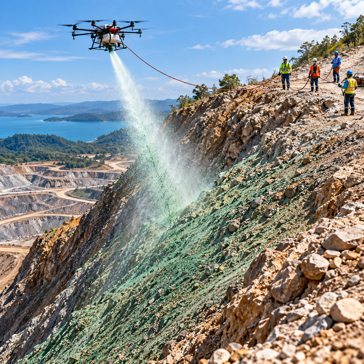
PT Trustone Borneo Indonesia deploys custom-engineered industrial drones supported by a dedicated Drone Lab & Maintenance Bay to execute complex environmental and safety missions without exposing field personnel to unstable terrain.
MINING SLOPE REVEGETATION (HYDROSEEDING)
Precision aerial spraying of seed, mulch, and soil stabilizers using modified 60 kg heavy-lift drones to restore steep and hazardous mining slopes safely.
MINING AREA MAPPING & MONITORING
High-resolution aerial survey, photogrammetry, and topographic modeling to support pit progression, stockpile calculation, and infrastructure planning.
ENVIRONMENTAL & RECLAMATION MONITORING
Continuous aerial tracking of vegetation growth, watershed conditions, and post-mining land reclamation compliance.
EARLY DETECTION OF FOREST & LAND FIRES
Thermal and optical UAV patrols to identify heat anomalies and smoke hotspots early across concession perimeters and surrounding forests.
DRONES FOR FIREFIGHTING TOOLS & TACTICAL SUPPORT
Deployment of specialized firefighting UAV units equipped for aerial situational awareness, extinguishing agent delivery, and tactical coordination in hard-to-reach industrial or terrain fire zones.
DEPLOY DRONE & ENVIRONMENTAL SERVICES AT YOUR SITE
Consult with our UAV flight engineers and environmental specialists for hydroseeding, topographic mapping, or fire surveillance proposals.